The High Divide Collaborative provides a working platform for partners to come together to build trust and develop collaborative goals and strategies, share science–based and landscape-scaled ecological, cultural, and economic data to support decision-making, and helps tell the story of High Divide resources and community-based conservation solutions designed to ensure their lasting conservation.
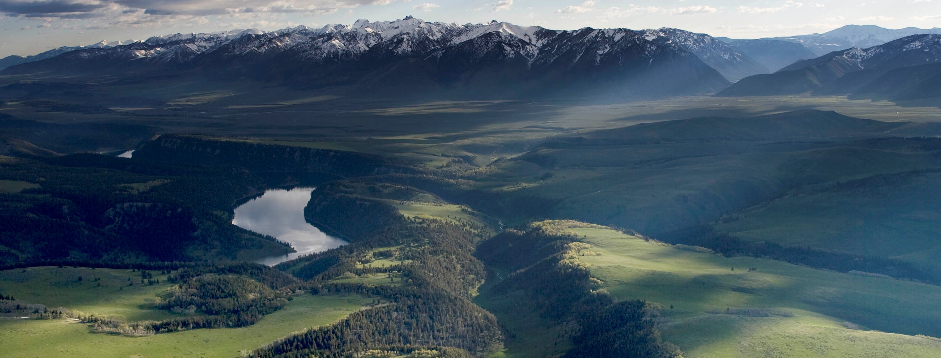
The Collaborative’s goals, objectives, and strategies are established by its participants. The High Divide landscape is a national treasure and our shared vision is to conserve:
that are central to communities, economy and way of life.
among core habitat areas to conserve wide-ranging fish and wildlife populations that are resilient to climate change.
of traditional food sources, tribal treaty lands, and travel ways such as the Nez Perce, Continental Divide, and Lewis & Clark Trails.
dispersed on nationally important lands and waterways where people enjoy nature.
for headwaters fisheries, wildlife, healthy riparian communities, and human uses.
that are intact, support sustainable ranching communities, and provide critical habitat for wildlife species, including the greater sage grouse.
managed for sustained economic, social and ecological values.
that provides open land to protect life and property, reduce fire costs, and allow wildfire to play its natural role.
We are increasing on-the-ground, locally-led conservation practices and contributing to the economic and social resilience of communities throughout the region we value and call home. We do this by building a diverse network of practitioners and landowners and expanding partnership knowledge and skills through peer learning.
Landscape Conservation Design (LCD) is a collaborative process that strives to create a long-term, landscape vision through the creation of spatial and strategic products that ultimately can inform future conservation decisions. LCD is participant-driven and iterative, led by landowners, conservation professionals, agency staff, and other stakeholders who value and live in the High Divide region.
The CoW-CIG team is working to innovate and evaluate non-lethal practices that reduce human-wildlife conflict. The goal of the project is to reduce the financial and social burden to producers of expanding predator populations on workinglands, leading to more resilient ranches, rural communities and maintenance of connected landscapes. The CoW-CIG team is researching costs, efficiency, and effectiveness of three practices – range riding, carcass management, and several fencing scenarios within varying ecological contexts to determine whether these practices should and could be incentivized and sustained via Natural Resources Conservation Service Farm Bill programs. These practices offer solutions for predation risk management on shared landscapes to support both livestock production and wildlife, including large predators.
This group was created to better understand the connectivity work happening in the High Divide and help fill in the gaps when possible. Their mission is to collaborate across boundaries and organizations maintain connected wildlife habitat and intact working lands across the High Divide. Currently, the group is working to better understand human-wildlife conflicts caused by roads and fences and exploring avenues for strategic problem solving around this issue.
The Forestry and Fire group has been focused on assessing aspen stand health, increasing confidence around working with landowners, and informing the Landscape Conservation Design using their forestry and wildfire expertise. The group’s recent meetings have centered around discussing aspen’s role in wildfire and ecosystem function, working with landowners, and better understanding frameworks for project prescriptions.
In 2016, local partners operating between the Northern Continental Divide and Greater Yellowstone ecosystems began visiting about building local capacity to reduce human- wildlife conflict. As a result of many conversations, the Big Hole Watershed Committee, Blackfoot Challenge, Centennial Valley Association, Confederated Salish and Kootenai Tribes (CSKT), Granite Headwaters Conservation District, Madison Valley Ranchlands Group, Swan Valley Connections/Swan Valley Bear Resources, Ruby Valley Conservation District/Watershed Council, and Watershed Restoration Coalition developed a committed partnership—the Landowner-Led Conflict Reduction Partnership (LLCRP)—to work together to support local efforts across nine-million acres. Together, they have built on the history of success of community-based conservation in their region and utilized tools to reduce conflicts between grizzly bears, wolves, and agricultural operations and communities. Their goals are to build durable solutions to sustain conflict reduction programs from year to year, ensure a future for local ranchers and producers, and create a permeable, nine-million-acre corridor of habitat to support new and existing conservation practices that collectively address landscape-scale connectivity. To address agricultural conflicts with carnivores, the groups deploy a diversity of tools, including livestock carcass removal, carcass composting, range riders, electric fencing, secured community refuse disposal sites, bear-resistant garbage cans at selected ranches and residences, and outreach and education.
This website will remain temporarily available to provide partners access to resources and view past work.
We plan to host one final gathering to round out this chapter. The High Divide Collaborative Celebration will take place later in summer of 2026, and we will be in touch via email with partners to provide more details in the coming months.
Thank you to all the partners who have collaborated and contributed valuable work over the years!